

Lewis
-
Posts
1,100 -
Joined
-
Last visited
-
Days Won
1
Reputation Activity
-


-

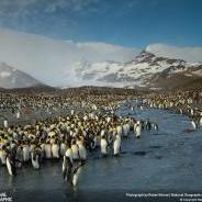
 Lewis got a reaction from Friends just call me Ross in Oceans
Record breaking Ocean heat last 3 days.
-

-

-
Lewis got a reaction from Mrs.Blessed in Oceans
John, totally agree with you on those scriptures.
If AMOC did collapse, I would expect it to be sometime during the great tribulation, not before.
Here's a quote from this article about the severity of AMOC if it does happen.
https://midmichigannow.com/news/nation-world/ocean-system-that-moves-heat-gets-closer-to-collapse-which-could-cause-weather-chaos
"An AMOC collapse would cause so many ripples throughout the world's climate that are “so abrupt and severe that they would be near impossible to adapt to in some locations,”
-

 Lewis reacted to Tortuga in Peace and Security, Great Tribulation, Armageddon
"You are going to hear of wars and reports of wars. See that you are not alarmed, for these things must take place, but the end is not yet."
-
Lewis reacted to Tortuga in Peace and Security, Great Tribulation, Armageddon
It came and went and there wasn't any declaration of P&S despite all of the guesses that a cure would be the trigger for P&S.
-
Lewis got a reaction from Watching and Waiting in ENSO
Status about same as last month.
EL NIÑO/SOUTHERN OSCILLATION (ENSO) DIAGNOSTIC DISCUSSION issued by
CLIMATE PREDICTION CENTER/NCEP/NWS 11 April 2024 ENSO Alert System Status: El Niño Advisory / La Niña Watch
Synopsis: A transition from El Niño to ENSO-neutral is likely by April-June 2024 (85% chance), with the odds of La Niña developing by June-August 2024 (60% chance).
During March 2024, sea surface temperature (SST) anomalies continued to weaken across most of the equatorial Pacific Ocean. SST anomalies were coolest in the far eastern Pacific Ocean [Fig. 1], with the latest weekly Niño-1+2 value at -0.1°C [Fig. 2]. Weekly SST index values in the other Niño regions were between +0.9°C and +1.2°C. Below-average subsurface temperatures strengthened (area-averaged index in [Fig. 3]), reflecting the expansion of negative subsurface anomalies associated with an upwelling Kelvin wave [Fig. 4]. Low-level wind anomalies were easterly over the west-central equatorial Pacific, while upper-level wind anomalies were mostly near average. Equatorial convection was slightly suppressed around the Date Line and was near average around Indonesia [Fig. 5]. Collectively, the coupled ocean-atmosphere system reflected the continued weakening of El Niño.
The most recent IRI plume indicates a transition to ENSO-neutral during spring 2024, with La Niña potentially developing during late summer 2024 [Fig. 6]. The forecast team continues to favor the dynamical model guidance, which is slightly more accurate than statistical models during this time of year. La Niña tends to follow strong El Niño events, which also provides added confidence in the model guidance favoring La Niña. In summary, a transition from El Niño to ENSO-neutral is likely by April-June 2024 (85% chance), with the odds of La Niña developing by June-August 2024 (60% chance; [Fig. 7]).
This discussion is a consolidated effort of the National Oceanic and Atmospheric Administration (NOAA), NOAA's National Weather Service, and their funded institutions. Oceanic and atmospheric conditions are updated weekly on the Climate Prediction Center web site (El Niño/La Niña Current Conditions and Expert Discussions). Additional perspectives and analysis are also available in an ENSO blog. A probabilistic strength forecast is available here. The next ENSO Diagnostics Discussion is scheduled for 9 May 2024.
-
Lewis got a reaction from Watching and Waiting in Global Temperature Monthly Update
Global Temperature Update for March 2024
Global Temperature for the month of March is the hottest on record for the 10th month in a row.
Global surface temperature was recorded at 1.39C (1951-1980 mean) or 1.66C (1880-1920 mean).NASA data (just noticed the graph above shows 1.41C but my chart from NASA says 1.39C)
We are currently holding at 1.64C for the year so far above the pre industrial (1880-1920 mean) NASA data
We have averaged 1.52C for the last 12 months.
April is on track to become hottest month already.
-
 Lewis got a reaction from Mike047 in ENSO
Status about same as last month.
EL NIÑO/SOUTHERN OSCILLATION (ENSO) DIAGNOSTIC DISCUSSION issued by
CLIMATE PREDICTION CENTER/NCEP/NWS 11 April 2024 ENSO Alert System Status: El Niño Advisory / La Niña Watch
Synopsis: A transition from El Niño to ENSO-neutral is likely by April-June 2024 (85% chance), with the odds of La Niña developing by June-August 2024 (60% chance).
During March 2024, sea surface temperature (SST) anomalies continued to weaken across most of the equatorial Pacific Ocean. SST anomalies were coolest in the far eastern Pacific Ocean [Fig. 1], with the latest weekly Niño-1+2 value at -0.1°C [Fig. 2]. Weekly SST index values in the other Niño regions were between +0.9°C and +1.2°C. Below-average subsurface temperatures strengthened (area-averaged index in [Fig. 3]), reflecting the expansion of negative subsurface anomalies associated with an upwelling Kelvin wave [Fig. 4]. Low-level wind anomalies were easterly over the west-central equatorial Pacific, while upper-level wind anomalies were mostly near average. Equatorial convection was slightly suppressed around the Date Line and was near average around Indonesia [Fig. 5]. Collectively, the coupled ocean-atmosphere system reflected the continued weakening of El Niño.
The most recent IRI plume indicates a transition to ENSO-neutral during spring 2024, with La Niña potentially developing during late summer 2024 [Fig. 6]. The forecast team continues to favor the dynamical model guidance, which is slightly more accurate than statistical models during this time of year. La Niña tends to follow strong El Niño events, which also provides added confidence in the model guidance favoring La Niña. In summary, a transition from El Niño to ENSO-neutral is likely by April-June 2024 (85% chance), with the odds of La Niña developing by June-August 2024 (60% chance; [Fig. 7]).
This discussion is a consolidated effort of the National Oceanic and Atmospheric Administration (NOAA), NOAA's National Weather Service, and their funded institutions. Oceanic and atmospheric conditions are updated weekly on the Climate Prediction Center web site (El Niño/La Niña Current Conditions and Expert Discussions). Additional perspectives and analysis are also available in an ENSO blog. A probabilistic strength forecast is available here. The next ENSO Diagnostics Discussion is scheduled for 9 May 2024.
-
 Lewis got a reaction from daydream in ENSO
Status about same as last month.
EL NIÑO/SOUTHERN OSCILLATION (ENSO) DIAGNOSTIC DISCUSSION issued by
CLIMATE PREDICTION CENTER/NCEP/NWS 11 April 2024 ENSO Alert System Status: El Niño Advisory / La Niña Watch
Synopsis: A transition from El Niño to ENSO-neutral is likely by April-June 2024 (85% chance), with the odds of La Niña developing by June-August 2024 (60% chance).
During March 2024, sea surface temperature (SST) anomalies continued to weaken across most of the equatorial Pacific Ocean. SST anomalies were coolest in the far eastern Pacific Ocean [Fig. 1], with the latest weekly Niño-1+2 value at -0.1°C [Fig. 2]. Weekly SST index values in the other Niño regions were between +0.9°C and +1.2°C. Below-average subsurface temperatures strengthened (area-averaged index in [Fig. 3]), reflecting the expansion of negative subsurface anomalies associated with an upwelling Kelvin wave [Fig. 4]. Low-level wind anomalies were easterly over the west-central equatorial Pacific, while upper-level wind anomalies were mostly near average. Equatorial convection was slightly suppressed around the Date Line and was near average around Indonesia [Fig. 5]. Collectively, the coupled ocean-atmosphere system reflected the continued weakening of El Niño.
The most recent IRI plume indicates a transition to ENSO-neutral during spring 2024, with La Niña potentially developing during late summer 2024 [Fig. 6]. The forecast team continues to favor the dynamical model guidance, which is slightly more accurate than statistical models during this time of year. La Niña tends to follow strong El Niño events, which also provides added confidence in the model guidance favoring La Niña. In summary, a transition from El Niño to ENSO-neutral is likely by April-June 2024 (85% chance), with the odds of La Niña developing by June-August 2024 (60% chance; [Fig. 7]).
This discussion is a consolidated effort of the National Oceanic and Atmospheric Administration (NOAA), NOAA's National Weather Service, and their funded institutions. Oceanic and atmospheric conditions are updated weekly on the Climate Prediction Center web site (El Niño/La Niña Current Conditions and Expert Discussions). Additional perspectives and analysis are also available in an ENSO blog. A probabilistic strength forecast is available here. The next ENSO Diagnostics Discussion is scheduled for 9 May 2024.
-
Lewis got a reaction from Friends just call me Ross in Global Temperature Monthly Update
Global Temperature Update for March 2024
Global Temperature for the month of March is the hottest on record for the 10th month in a row.
Global surface temperature was recorded at 1.39C (1951-1980 mean) or 1.66C (1880-1920 mean).NASA data (just noticed the graph above shows 1.41C but my chart from NASA says 1.39C)
We are currently holding at 1.64C for the year so far above the pre industrial (1880-1920 mean) NASA data
We have averaged 1.52C for the last 12 months.
April is on track to become hottest month already.
-
Lewis got a reaction from Friends just call me Ross in Seeing the real effects of climate changes locally
And now you have mass bleaching happening at the Great Barrier Reef. https://www.theguardian.com/environment/2024/apr/11/great-barrier-reef-severe-coral-bleaching-impact
According to the IPCC, at 2C warming, 99% of reefs will die.
-
Lewis got a reaction from Friends just call me Ross in Arctic Sea Ice
Latest news on the Arctic has come out that we should expect a Blue Ocean Event within 10 years as early as this year (highly doubt it).. Scientists are now discussing this issue and an article has come out to alert the world.
https://phys.org/news/2024-03-arctic-ice-free-decade-scientists.html
A blue Ocean Event is considered in having less than 1 million square km of ice, at that point ice would be in chunks and scattered.
-
Lewis got a reaction from Friends just call me Ross in ENSO
Status about same as last month.
EL NIÑO/SOUTHERN OSCILLATION (ENSO) DIAGNOSTIC DISCUSSION issued by
CLIMATE PREDICTION CENTER/NCEP/NWS 11 April 2024 ENSO Alert System Status: El Niño Advisory / La Niña Watch
Synopsis: A transition from El Niño to ENSO-neutral is likely by April-June 2024 (85% chance), with the odds of La Niña developing by June-August 2024 (60% chance).
During March 2024, sea surface temperature (SST) anomalies continued to weaken across most of the equatorial Pacific Ocean. SST anomalies were coolest in the far eastern Pacific Ocean [Fig. 1], with the latest weekly Niño-1+2 value at -0.1°C [Fig. 2]. Weekly SST index values in the other Niño regions were between +0.9°C and +1.2°C. Below-average subsurface temperatures strengthened (area-averaged index in [Fig. 3]), reflecting the expansion of negative subsurface anomalies associated with an upwelling Kelvin wave [Fig. 4]. Low-level wind anomalies were easterly over the west-central equatorial Pacific, while upper-level wind anomalies were mostly near average. Equatorial convection was slightly suppressed around the Date Line and was near average around Indonesia [Fig. 5]. Collectively, the coupled ocean-atmosphere system reflected the continued weakening of El Niño.
The most recent IRI plume indicates a transition to ENSO-neutral during spring 2024, with La Niña potentially developing during late summer 2024 [Fig. 6]. The forecast team continues to favor the dynamical model guidance, which is slightly more accurate than statistical models during this time of year. La Niña tends to follow strong El Niño events, which also provides added confidence in the model guidance favoring La Niña. In summary, a transition from El Niño to ENSO-neutral is likely by April-June 2024 (85% chance), with the odds of La Niña developing by June-August 2024 (60% chance; [Fig. 7]).
This discussion is a consolidated effort of the National Oceanic and Atmospheric Administration (NOAA), NOAA's National Weather Service, and their funded institutions. Oceanic and atmospheric conditions are updated weekly on the Climate Prediction Center web site (El Niño/La Niña Current Conditions and Expert Discussions). Additional perspectives and analysis are also available in an ENSO blog. A probabilistic strength forecast is available here. The next ENSO Diagnostics Discussion is scheduled for 9 May 2024.
-
Lewis got a reaction from JW-Ind in Global Temperature Monthly Update
Global Temperature Update for March 2024
Global Temperature for the month of March is the hottest on record for the 10th month in a row.
Global surface temperature was recorded at 1.39C (1951-1980 mean) or 1.66C (1880-1920 mean).NASA data (just noticed the graph above shows 1.41C but my chart from NASA says 1.39C)
We are currently holding at 1.64C for the year so far above the pre industrial (1880-1920 mean) NASA data
We have averaged 1.52C for the last 12 months.
April is on track to become hottest month already.
-
Lewis got a reaction from JW-Ind in Arctic Sea Ice
Latest news on the Arctic has come out that we should expect a Blue Ocean Event within 10 years as early as this year (highly doubt it).. Scientists are now discussing this issue and an article has come out to alert the world.
https://phys.org/news/2024-03-arctic-ice-free-decade-scientists.html
A blue Ocean Event is considered in having less than 1 million square km of ice, at that point ice would be in chunks and scattered.
-
 Lewis got a reaction from hatcheckgirl in Seeing the real effects of climate changes locally
And now you have mass bleaching happening at the Great Barrier Reef. https://www.theguardian.com/environment/2024/apr/11/great-barrier-reef-severe-coral-bleaching-impact
According to the IPCC, at 2C warming, 99% of reefs will die.
-
 Lewis got a reaction from Dolce vita in Arctic Sea Ice
Latest news on the Arctic has come out that we should expect a Blue Ocean Event within 10 years as early as this year (highly doubt it).. Scientists are now discussing this issue and an article has come out to alert the world.
https://phys.org/news/2024-03-arctic-ice-free-decade-scientists.html
A blue Ocean Event is considered in having less than 1 million square km of ice, at that point ice would be in chunks and scattered.
-
Lewis reacted to hatcheckgirl in Seeing the real effects of climate changes locally
Well, I knew this past summer over in the West parts of Australia was particularly punishing. A walk in the bush tells us that there are many trees and bushes really struggling, and drying. When we go witnessing, people's gardens are much drier and more plants have died.
It’s April, and we have not seen rain in many months, making it a record-breaking spell.
Fears of another 'forest collapse' event in Western Australia after record dry spell
So, it's not just me then…..
Other parts of Australia are suffering their 12th flood of catastrophic proportions in 4 years. We are sick of hearing “unprecedented” and “once-in-a-hundred years flood”.
https://www.abc.net.au/news/2024-04-11/shoalhaven-farmers-flooded-for-12th-time-in-four-years/103685588
Are you seeing catastrophic changes in your local climate too?
-
Lewis got a reaction from hatcheckgirl in ENSO
Status about same as last month.
EL NIÑO/SOUTHERN OSCILLATION (ENSO) DIAGNOSTIC DISCUSSION issued by
CLIMATE PREDICTION CENTER/NCEP/NWS 11 April 2024 ENSO Alert System Status: El Niño Advisory / La Niña Watch
Synopsis: A transition from El Niño to ENSO-neutral is likely by April-June 2024 (85% chance), with the odds of La Niña developing by June-August 2024 (60% chance).
During March 2024, sea surface temperature (SST) anomalies continued to weaken across most of the equatorial Pacific Ocean. SST anomalies were coolest in the far eastern Pacific Ocean [Fig. 1], with the latest weekly Niño-1+2 value at -0.1°C [Fig. 2]. Weekly SST index values in the other Niño regions were between +0.9°C and +1.2°C. Below-average subsurface temperatures strengthened (area-averaged index in [Fig. 3]), reflecting the expansion of negative subsurface anomalies associated with an upwelling Kelvin wave [Fig. 4]. Low-level wind anomalies were easterly over the west-central equatorial Pacific, while upper-level wind anomalies were mostly near average. Equatorial convection was slightly suppressed around the Date Line and was near average around Indonesia [Fig. 5]. Collectively, the coupled ocean-atmosphere system reflected the continued weakening of El Niño.
The most recent IRI plume indicates a transition to ENSO-neutral during spring 2024, with La Niña potentially developing during late summer 2024 [Fig. 6]. The forecast team continues to favor the dynamical model guidance, which is slightly more accurate than statistical models during this time of year. La Niña tends to follow strong El Niño events, which also provides added confidence in the model guidance favoring La Niña. In summary, a transition from El Niño to ENSO-neutral is likely by April-June 2024 (85% chance), with the odds of La Niña developing by June-August 2024 (60% chance; [Fig. 7]).
This discussion is a consolidated effort of the National Oceanic and Atmospheric Administration (NOAA), NOAA's National Weather Service, and their funded institutions. Oceanic and atmospheric conditions are updated weekly on the Climate Prediction Center web site (El Niño/La Niña Current Conditions and Expert Discussions). Additional perspectives and analysis are also available in an ENSO blog. A probabilistic strength forecast is available here. The next ENSO Diagnostics Discussion is scheduled for 9 May 2024.
-
Lewis reacted to SheyZ in Global Temperature Monthly Update
I've read on JW talk some of the friends are thinking oh about 10 years before this system ends. I don't believe that's even possible with the earth wide mess we are in.
Not just global warming.
I know why some think 10 years because they're counting 120 years preaching that Noah did & counting from 1914.
-
Lewis reacted to SheyZ in Global Temperature Monthly Update
Really enjoyed that article you shared..
-
Lewis got a reaction from Friends just call me Ross in Global Temperature Monthly Update
James Hansen a former top scientist for NASA (who is known as the godfather of this topic) sounded the alarm back in 2022 and released a report titled Global Warming in the Pipeline. It’s perplexing for them because EEI (Earths Energy Imbalance) is hard to measure against a climate response time, there are so many factors involved to knowing how our weather will respond and when with accuracy. That report goes in great detail and James and his team predicted 2023 & 2024 to be hottest back in 2022 based on their modeling samples and that our EEI will continue to get worst.
-
Lewis got a reaction from Friends just call me Ross in Global Temperature Monthly Update
Preliminary showing March 2024 is hottest for the 10th month in a row on record at about roughly 1.65C above preindustrial, wont know final figures for another week.
About JWTalk.net - Jehovah's Witnesses Online Community
Since 2006, JWTalk has proved to be a well-moderated online community for real Jehovah's Witnesses on the web. However, our community is not an official website of Jehovah's Witnesses. It is not endorsed, sponsored, or maintained by any legal entity used by Jehovah's Witnesses. We are a pro-JW community maintained by brothers and sisters around the world. We expect all community members to be active publishers in their congregations, therefore, please do not apply for membership if you are not currently one of Jehovah's Witnesses.