-
Welcome to the real Jehovah's Witnesses Online Community!
Welcome to JWTalk! JWTalk.Net is the only online community for real, actual Jehovah's Witnesses - those who are active, loyal, publishers of God's Kingdom - where you can speak with brothers and sisters from all around the world on a wide variety of topics.
All Activity
- Past hour
-

Peace and Security, Great Tribulation, Armageddon
Indapipe replied to Dhanyel's topic in Secular News in the Mainstream Media
https://jw-japan.org/en/representatives-of-jehovahs-witnesses-meet-with-the-children-and-families-agency/?utm_source=chatgpt.com -
Peace and Security, Great Tribulation, Armageddon
Indapipe replied to Dhanyel's topic in Secular News in the Mainstream Media
Just a small correction sis: Jedele; there is no 'o' in his last name. The first time I figured it was a typo...but then I saw you spell it the same in 3 different posts. Unless you are deliberately combining his first and last name, Jody Jedele, into one word. 😄 - Today
-
Publishers baptized within a year
carlos replied to jholland's topic in Computers, Tablets, Mobile Devices, & Apps
Jeremy, do you mean using NW Scheduler? If that is what you mean, there is a report in NW Scheduler that allows you to list publishers baptized in the last year. Go to Printing (the printer icon), "Save, Print and Email Reports", select Secretary from the dropdown list, the last report listed is publishers baptized in the last year. Have a look to see if that's what you need. If that is not what you need, there is another option although a bit less straightforward. Go to Printing, select Persons, Persons Spiritual Summary, select only those baptized and export as Document. You will obtain a table, one row per publishers, with several data including their baptism date. Remove all the columns you don't need and order the remaining columns by date. Or copy it to Excel and work there. -
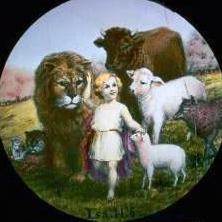
 We tend to imagine Paradise based on the life we know today. But after thousands of years, life might be so wonderful and different that our present imagination cannot even come close to it! ❤️
 -
 We usually think of the first few years of life in the new system, have you ever wondered what life will be like after a few thousand years?
 -
A happy family in NW.. gemini_generated_video_98432f54.mp4
-
-
 Latin America shift right. I’m some what ambidextrous. I hope both sides does not try to pull me in the middle. It will effect my balance with my intake of eating chocolate.
 -

Publishers baptized within a year
Dages replied to jholland's topic in Computers, Tablets, Mobile Devices, & Apps
No. Unless you have inserted all these data in an excel file and want to sort them. I'm not sure it's ok depending on the Law of your area though -

Publishers baptized within a year
jholland replied to jholland's topic in Computers, Tablets, Mobile Devices, & Apps
Understood. But is there a simple way to list the publishers by their baptism date rather than looking at them 1 by 1? -
Publishers baptized within a year
Dages replied to jholland's topic in Computers, Tablets, Mobile Devices, & Apps
The secretary has all the spiritual info of the brothers and sisters of the congregation. -

2027 International Convention dates
Bluebell replied to Brandon's topic in JW.org Press Releases & JW's in the News
Not so long anymore...... -
Publishers baptized within a year
jholland replied to jholland's topic in Computers, Tablets, Mobile Devices, & Apps
Thanks. Could you provide a little more direction on how this can "easily" be done? -
Man I sure hope I don't have to walk any of our more technically challenged users through these steps! 😬
-
It is not just politics, it can be local news and we need to keep up dated with local news.
-
Publishers baptized within a year
Dages replied to jholland's topic in Computers, Tablets, Mobile Devices, & Apps
You can easily if you are the Secretary of your congregation. -
Just to explain. It is my main priority to publish the primary book of the New World as a complete story of a possibility what could happen. With the resurrection, the harmony of Perfect People with great respect of our God Jehovah. Take yourself as part of one of the survivors. He helps with building and developing the New World. At the end he gets a new assignment and also talked with Daniel, John the Baptist and Noah. Much details about the resurrection. A complete book, also with the last temptation of Satan. Then it ends for now. Of course fantasy Not translated are the other 4 books, but who knows. They are all part of the New World.
-
Is there a simple way to gather a list of publishers that have been baptized within a certain period? As an example, those coming up on a 1 year visit. I realize it will appear in my tasks when they are approaching 1 year, but a list to confirm that no one was missed would be helpful. Thanks!
-

Peace and Security, Great Tribulation, Armageddon
jeje replied to Dhanyel's topic in Secular News in the Mainstream Media
However, Jehovah will not let the earth at the point it's not habitable anymore -
 Serbia’s Vucic concedes election defeat to student-led movement https://www.aljazeera.com/news/2026/10/25/serbia-voter-turnout-highest-in-decades-as-students-oppose-longtime-leader
 -

Peace and Security, Great Tribulation, Armageddon
Dhanyel replied to Dhanyel's topic in Secular News in the Mainstream Media
KEEP ON THE WATCH! Political Violence—What Does the Bible Say? https://www.jw.org/en/library/series/more-topics/political-violence-bible-say/ -
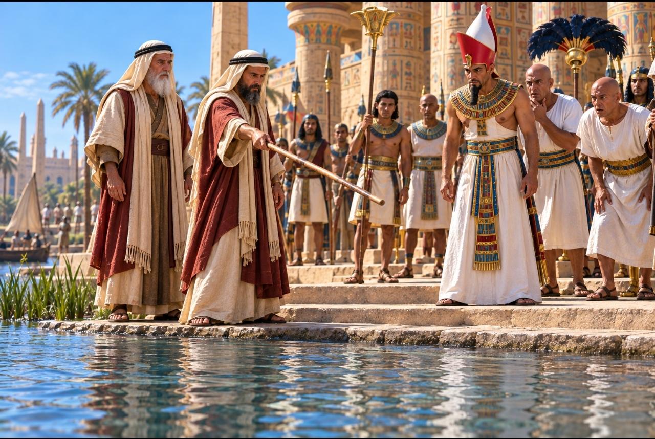
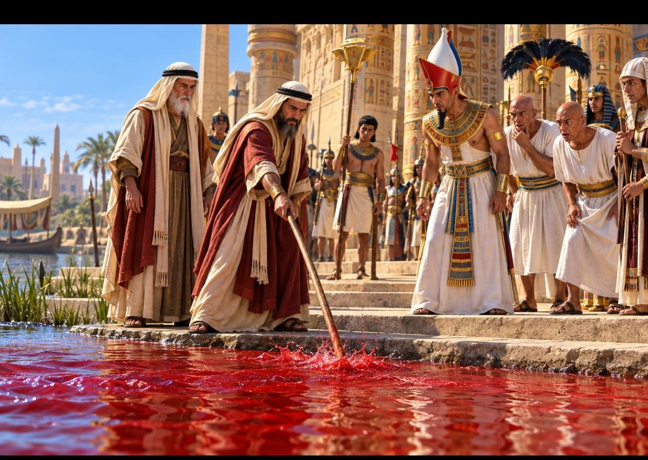
Yes, so I tried with deep crimson red color then just red color.. But I'm still getting the same message..
-
maybe the word "blood" is bad ?
-
0–3 seconds: Inside a dark, rocky lions’ den, elderly Daniel, with white hair and a long white beard, crouches on the ground in fear. Several realistic lions slowly approach and sniff his face and clothes. Daniel trembles, leans backward, and looks terrified, his eyes wide and breathing nervous. 3–6 seconds: The lions suddenly notice a powerful angel standing behind Daniel. The angel has short white hair, a white beard, large white wings, and flowing white robes. The lions turn their heads toward the angel, their expressions changing from threatening to cautious. The angel stands calmly, protecting Daniel. 6–8 seconds: The lions slowly step backward, lower their heads, and retreat from Daniel without attacking him. Their tails move gently as they back away. Daniel watches in disbelief, his frightened expression beginning to change. 8–10 seconds: Daniel looks from the retreating lions toward the angel, his eyes wide with surprise and relief. He slowly realizes that the lions are not going to harm him. His expression shows astonishment and gratitude. Camera: Begin with a close-up of a lion sniffing Daniel, then show Daniel’s terrified face, followed by the lions noticing the angel and backing away. End with a close-up of Daniel’s surprised expression. Lighting and sound: Dim cave lighting with realistic sunlight streaming through the opening. Deep, dramatic orchestral music builds as the lions approach, then changes to majestic, peaceful music as the angel protects Daniel. Include subtle lion breathing, pawsteps on stone, and Daniel’s nervous breathing. Important: Daniel must look very old, with realistic wrinkles, white hair, and a long white beard. His fear and surprise must be clearly visible. The lions must look completely realistic, not cartoonish. The angel has short white hair and a white beard. The lions must look toward the angel before backing away. No attacks, no injuries, no sudden scene changes. Maintain consistent characters, clothing, and cave surroundings throughout the video.
-
I tried creating a video using these pictures, but both Gemini and Flow refused, saying that the scene depicts a dangerous situation.🙁




.thumb.gif.503be83d9b641351930371e757a10eb4.gif)



-
Who's Online 32 Members, 0 Anonymous, 919 Guests (See full list)
-
Upcoming Events
-
Our picks
-
Post in 1975 End of World ?
jwhess posted a post in a topic,
Modern references to creative days:
*** w15 6/1 p. 5 How Science Affects Your Life ***
The Bible fixes no duration for the six creative “days.” Instead, it opens the door for modern scientists to study them and assign accurate time spans to them. We know that the creative “days” were much longer than 24-hour days.
*** g21 No. 3 p. 12 What the Bible Tells Us ***
So each of the six creative “days” during which God prepared the earth for life and created life on it could represent extremely long periods of time.
*** g 1/14 p. 12 Creation ***
WHAT THE BIBLE SAYS God created the universe, including the earth, in the indefinite past—“in the beginning,” as Genesis 1:1 says. Modern science agrees that the universe had a beginning. A recent scientific model suggests it to be almost 14 billion years old.
*** lc pp. 26 Science and the Genesis Account ***
A careful consideration of the Genesis account reveals that events starting during one “day” continued into one or more of the following “days.”
Picked By
trottigy, -
-
-
Recent Public Status Updates
-
 After the death of the last apostle, and the disappearance of the apostolic authority, many different Christian denominations emerged and this continues to this day. Dozens, then hundreds, and thousands conflicting points of view of the nature of God, salvation and morals were co-existing. They, of course, cannot all please God. They cannot all be following the teachings of Christ.· 0 replies
At the same time, the Lord predicted there would be a day when he would be inspecting his temple, meaning he would examine all those who professed to be anointed by the Spirit.
This day came in 1919, the year after the first World War. That great massacre truly was the catalyst that triggered Christ to come and see what the Churches were teaching and how their members reacted during the war. Among all the denominations that were active on earth, only one caught the attention of Christ. It was not the wealthiest, it was not the most numerous, but it was the most sincere and the most watchful. Why?
The Catholic Church, the Orthodox Churches, the Protestant Churches, the Oriental Churches…all have been active for centuries. They had plenty of ressources, plenty of time and plenty of opportunities to teach the fundamental truths about God and his Kingdom. But despite that, none of them was doing that in spite of their longetivity. But here was a tiny group of students of the Bible who, with their limited means and facing numerous opposition, overcame what seemed to be insurmontable obstacles and were spreading the true Gospel. Only this small fellowship of studious Christians had the courage to carefully examine the Scriptures so as to return to the original doctrines of Jesus Christ, stripping away traditions that had piled up over the centuries that dishonored Jehovah God.
The Associated Bible Students, as the congregation was called, were the only ones who taught that:
• Jehovah is the name of the only true God.
• The Kingdom of God is a heavenly realm that will soon rule over the earth.
• The dead are unconscious and awaiting a resurrection.
• Military service and political involvment must be avoided.
• Christians have to spread the Good News to their neighbors.
They have been associated for a few years and they had already understood these vital facts, while other churches who had been here longer intead taught that God is a mysterious trinity, that the souls of the damned are either in purgatory or a fiery hell, that Christians can engage with the political systems and conflicts of this world, and that the Kingdom of God is the Church.
So it is no surprise that the Lord Jesus was pleased with them, for they had the desire for truth and worship God according to his will, not according to the traditions of man. Hence, Jesus selected them specifically to feed his sheep as the prophecied ‘Faithful and Discreet Slave’, all while refining their understand and organization over the years. And that is how, today, Jehovah’s Witnesses continue to be guided by the head of the Congregation until they are gathered up into Heaven for some, and survive the Great Tribulation unto Paradise earth for others.
-

-
In ancient Jerusalem, Shebna held the highly influential position of royal steward, making him the governor over King Hezekiah's palace and household.· 0 replies
Instead of humby executing his duties during a critical Assyrian invasion threat, Shebna abused his high office to seek personal prestige and political glory. His ultimate act of arrogance was carving out a lavish, prominent tomb for himself on a high rocky cliff, a privilege traditionally reserved for kings.
Because of this pride, Jehovah denounced Shebna through the prophet Isaiah and decreed that he would be violently hurled away and stripped of his official standing.
God then called his humble servant Eliakim, clothed him in Shebna's official robe and sash, and completely transferred the governmental dominion into his hand. To signify this supreme administrative authority, Jehovah symbolically placed the key of the royal house of David directly upon Eliakim's shoulder. With this key of absolute governance, Eliakim gained the ultimate power to open doors that no man could shut and to shut doors that no man could open.
This prophetic framework uses ancient characters as specific "types" to mirror the modern development of Jehovah's Witnesses' organizational structure. King Hezekiah represents the glorified Jesus Christ, who rules as the rightful heavenly King and fiercely protects his loyal followers from spiritual enemies. Eliakim represents the anointed "faithful and discreet slave" appointed to feed God's household. The Governing Body acts as the visible, administrative leadership of this Eliakim class, directing all global operations in the name of the heavenly King.
Conversely, the unfaithful steward Shebna represents the clergy of Christendom, who claimed exclusive rights to spiritual governance over Christ's household.
Jesus inspected these religious systems and officially rejected them in 1918 because they sought political prestige, human titles, and worldly glory. By removing this modern-day Shebna, Jesus is believed to have transferred complete earthly authority to the Governing Body, making it his sole delegated intendant.
By utilizing the delegated power to "open," the Governing Body unlocks doors of spiritual activity by initiating massive global preaching campaigns and entry into new territories. It also opens the way for the transmission of divine knowledge by supervising the translation, production, and distribution of scriptural literature through JW.org. Furthermore, this authority allows it to open doors of organizational privilege by establishing the spiritual qualifications required to appoint elders, ministerial servants, and pioneers.
In contrast, the power to "shut" is exercised when the Governing Body bars the clergy of Christendom from claiming any divine legitimacy or stewardship over God's people. It also uses this authority to shut out false teachings, protecting the worldwide brotherhood from apostate ideas and secular philosophies that could corrupt congregation purity. Administratively, "shutting" gives it the final authority to enforce judicial measures, including the severe restriction of fellowship or the total expulsion of unrepentant wrongdoers. Ultimately, these dual actions ensure that the Governing Body maintains strict, centralized authority over who is admitted into Jehovah's earthly organization and who is excluded from it.
-

-
Welcome to JWTalk, Brother Anthony! 😊 Warm greetings from Massachusetts. I see you’re in Lima—are you near the coast, or farther inland? Glad you’ve joined us. Make yourself at home!· 0 replies
-
-
Welcome to JWTalk, Brother Jay! 😊 Warm greetings from Massachusetts. I see you’re in the Philippines—are you near Manila, or on one of the other islands? Glad you’ve joined us. Make yourself at home!· 0 replies
-
-
-
-
-
Albums
-
👀
- By Line,
- 0
- 0
- 1
-

mysore ( India)
- By Jess j,
- 0
- 0
- 5
-

Scriptural consideration
- By DLJBSP,
- 0
- 1
- 3
-

Giants - Glimpses of Wonder Blog on JWtalk.net
- By DLJBSP,
- 2
- 0
- 60
-

Golden Beetle - Glimpses of Wonder Blog on JWtalk.net
- By DLJBSP,
- 0
- 0
- 4
-
About JWTalk.net - Jehovah's Witnesses Online Community
Since 2006, JWTalk has proved to be a well-moderated online community for real Jehovah's Witnesses on the web. However, our community is not an official website of Jehovah's Witnesses. It is not endorsed, sponsored, or maintained by any legal entity used by Jehovah's Witnesses. We are a pro-JW community maintained by brothers and sisters around the world. We expect all community members to be active publishers in their congregations, therefore, please do not apply for membership if you are not currently one of Jehovah's Witnesses.